
Garmin GPSMAP 79s
4.2Editor score
Rugged floating design
IPX6 water-resistant rating
Worldwide basemap included
Navigating the open water requires reliable technology to ensure safety and efficiency on every trip. Marine GPS units provide critical location data, route planning, and real-time tracking for boaters of all experience levels.
We analyzed ten top-rated models based on display quality, mapping capabilities, sonar integration, and connectivity options. Each product was evaluated for its suitability across different vessel types and specific maritime environments.
Every pick highlights key strengths and potential limitations to help you make an informed decision. Please note that prices and availability change frequently, so check current listings before purchasing.
4.2Editor score

5.0Editor score

As an Amazon Associate we earn from qualifying purchases.
The following table offers a side-by-side comparison of all ten selected marine GPS units, highlighting their core specifications and unique selling points for easy evaluation.


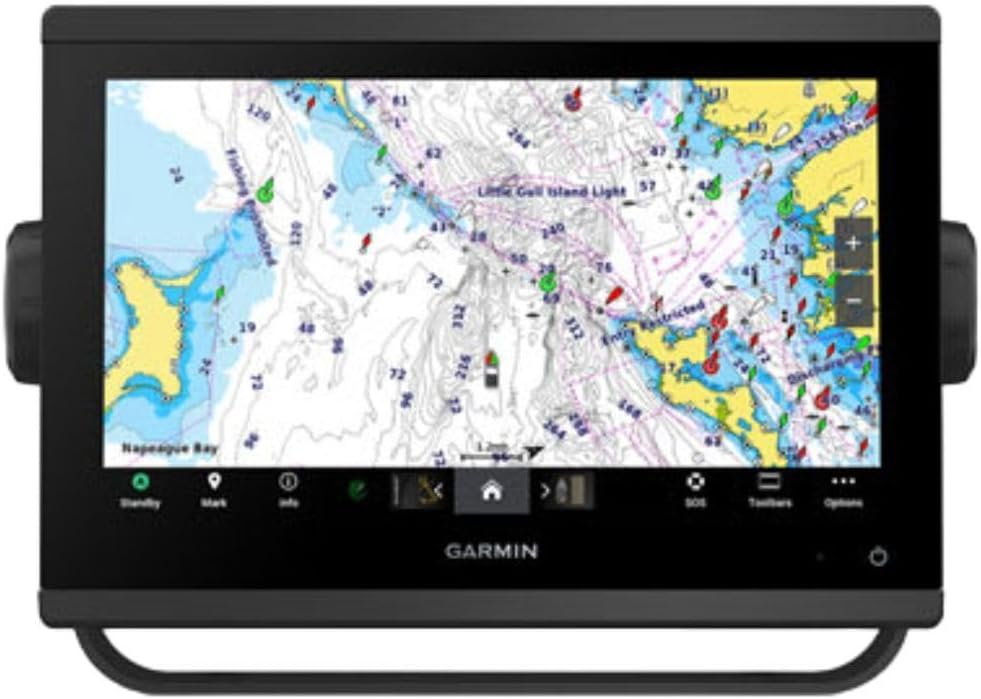


The Garmin GPSMAP 1223xsv Combo stands out as a top-tier navigation solution for serious boaters. With a perfect 5.0 rating from users, it combines a large 12-inch display with powerful sonar capabilities to deliver exceptional performance on the water.
We may earn a commission when you buy through this link, at no additional cost to you.
Its 5,000-watt CHIRP traditional sonar provides clear target separation even in deep water, while ClearVü and SideVü scanning offer detailed views of fish and structure. The J1939 connectivity allows seamless integration with compatible engines and autopilots, making it a central hub for your marine electronics.
While the unit is larger and pricier than handheld options, the trade-off is justified by the superior screen real estate and comprehensive mapping features. The included worldwide basemap ensures you can navigate coastal areas, lakes, and rivers globally without immediate extra purchases.
This model is ideal for captains who demand precision and reliability. If you prioritize high-quality imaging and robust networking for a serious fishing or cruising vessel, this unit is a highly recommended choice for long-term value.
The 12-inch IPS panel ensures critical navigation data remains visible even under direct sunlight, reducing eye strain during long voyages.
Built-in CHIRP and scanning sonars provide detailed underwater imagery, helping you locate specific fish targets and bottom structures efficiently.
We may earn a commission when you buy through this link, at no additional cost to you.
The Simrad GO Chartplotter is a versatile device designed for sportboats and smaller cruisers. It combines GPS navigation, sonar support, and radar capability in one multifunction display. Users appreciate the included C-MAP Discover card which offers full-featured Vector Charts and ultra-wide coverage.
We may earn a commission when you buy through this link, at no additional cost to you.
Integration is seamless thanks to built-in Wi-Fi and NMEA 2000 support. You can mirror the display to a smartphone or tablet for convenient access to charts and radar from anywhere on board. The HDI transducer provides clear CHIRP sonar and DownScan Imaging for identifying bottom structure.
While the system is powerful, the initial setup might require some technical know-how to configure NMEA connections correctly. Additionally, full radar capabilities often require purchasing extra hardware separately, which can increase the total cost of ownership.
This unit is perfect for boaters who want a scalable system that grows with their vessel. If you need a compact yet capable plotter for recreational use with strong charting options, this is a solid contender in the market.
The C-MAP Discover card includes high-resolution bathymetric contours and depth shading for accurate route planning in coastal waters.
Wireless mirroring allows you to extend the interface to mobile devices, offering flexible viewing options for the crew.
We may earn a commission when you buy through this link, at no additional cost to you.
The Garmin ECHOMAP UHD2 94sv delivers a bright 9-inch touchscreen experience that is easy to read even in harsh sunlight. It comes with the GT56 transducer, enabling traditional, ClearVü, and SideVü scanning sonars right out of the box. Navionics+ coastal charts are integrated for immediate navigation.
We may earn a commission when you buy through this link, at no additional cost to you.
Connectivity is a strong point with built-in Wi-Fi that allows wirelessly sharing sonar data and routes with other units. It also connects to Force trolling motors to control speed and navigate to waypoints directly. This integration makes it highly efficient for anglers.
The only limitation is the screen size compared to larger 12-inch models which might be less ideal for complex multi-window views. However, for most recreational boats, the clarity and speed of the touch interface provide an excellent user experience without bulk.
If you want a reliable chartplotter with excellent sonar imaging included, this model is a great balance of performance and price. It suits freshwater and coastal users who need detailed scanning sonar without buying separate transducers.
ClearVü and SideVü scanning provide detailed side imaging, helping you identify structure and fish with high resolution.
Seamless connection to Force trolling motors allows for automated navigation routes and speed control from the plotter.
We may earn a commission when you buy through this link, at no additional cost to you.
The Garmin 010-02366-61 GPSMAP 943xsv focuses on delivering ultra high-definition scanning sonar for exceptional underwater visibility. It supports Panoptix sonar which offers real-time views of fish activity. The display optics are improved for better clarity in various lighting conditions.
We may earn a commission when you buy through this link, at no additional cost to you.
Pre-loaded mapping means you can start navigating immediately upon installation. The unit is designed to integrate well with other Garmin devices. Its optics are optimized to reduce glare and maintain visibility during bright days on open water.
While it offers excellent sonar performance, it is priced higher than basic models. Some advanced features might require additional sensors or charts. However, the investment pays off in terms of imaging quality and reliability for fishing focused vessels.
This is a strong choice for anglers who prioritize sonar performance over sheer screen size. If seeing fish and structure clearly is your main goal, the HD scanning capabilities provide a distinct advantage over older units.
Panoptix support allows for live sonar views, providing immediate feedback on fish and structure movement.
Improved display optics ensure high contrast and sharpness, making details easy to read in sunlight.
We may earn a commission when you buy through this link, at no additional cost to you.
The Garmin GPSMAP 1243xsv w/GMR 18 HD3 represents a premium tier of marine navigation designed for complex vessel systems. It supports OneHelm digital switching to control your marine experience remotely. Preloaded Navionics+ charts provide detailed coverage for any waters.
We may earn a commission when you buy through this link, at no additional cost to you.
You can expand engine compatibility and connect third-party devices via the network. The system is built for superior connectivity allowing you to manage autopilots and switches directly. This level of integration is unmatched in standard chartplotters.
The investment is significant and the setup may require professional installation for optimal performance. It is not necessary for small boats but shines on large yachts. The ability to control systems remotely adds convenience and safety for long voyages.
If you are outfitting a high-end vessel with advanced electronics, this unit acts as a central command hub. It delivers the connectivity and control needed for serious offshore cruising and modern digital boat management.
OneHelm switching allows you to control lighting and pumps remotely through the chartplotter interface.
Navionics+ charts include detailed depth data and contours for safe navigation in unfamiliar waters.
We may earn a commission when you buy through this link, at no additional cost to you.
The Garmin GPSMAP 79sc is a rugged floating handheld GPS perfect for kayakers and small boat owners. It features a high-resolution color display and is designed to float in water. The unit is IPX6 water-resistant to protect against splashes and rain.
We may earn a commission when you buy through this link, at no additional cost to you.
Preloaded BlueChart g3 coastal charts provide essential navigation data immediately. It supports multiple satellite constellations for reliable tracking worldwide. The battery lasts up to 20 hours in GPS mode which is sufficient for a full day trip.
While the screen is smaller than fixed units, the portability and durability make it an excellent backup or primary tool for small craft. The memory can save up to 10,000 waypoints which ensures you have space for detailed route planning.
This handheld is an ideal budget choice for those needing a reliable emergency GPS. If you want a device that won't sink and fits in a pocket without needing a mount, this is a practical and cost effective solution.
The floating and rugged design ensures that if you drop the unit overboard, it remains accessible and safe from damage.
Support for GLONASS and Galileo systems ensures accurate positioning even in challenging terrain or open water.
We may earn a commission when you buy through this link, at no additional cost to you.
The Garmin GPSMAP 79s offers global navigation with a worldwide basemap preloaded on the unit. It is designed to float and features a rugged build for outdoor use. The IPX6 rating protects it from water damage during heavy splashing.
We may earn a commission when you buy through this link, at no additional cost to you.
Tracking is reliable thanks to support for multiple satellite constellations. The unit can save 10,000 waypoints for extensive trip logging. Battery life extends up to 20 hours so you can rely on it for long journeys without frequent charging.
Unlike the 79sc model this version does not include detailed coastal charts but focuses on a global basemap. This is suitable for travelers needing basic positioning rather than detailed local depth contours. The simplicity is a benefit for those avoiding complex maps.
If you need a universal GPS for travel or basic boating without detailed charts, this model is efficient. It serves well as a secondary safety device on larger boats where detailed mapping is handled by a fixed unit.
The worldwide basemap ensures you have basic location data available no matter where you navigate globally.
Rugged construction and water resistance make it ideal for harsh environments and high spray conditions.
We may earn a commission when you buy through this link, at no additional cost to you.
The Garmin GPSMAP1022XSV provides a large 10-inch display for fixed mounting on boats. It comes with a basemap but does not include a transducer. This setup is ideal if you plan to purchase a separate sonar module for your vessel.
We may earn a commission when you buy through this link, at no additional cost to you.
It supports combo functionality allowing integration with fishfinder systems. The screen is clear and easy to read in various light conditions. Garmin International ensures reliability through international standards and robust engineering.
The lack of an included transducer reduces the initial cost but adds steps to the installation process. Users must ensure compatibility of additional hardware. This is a good option for those customizing their marine electronics setup.
If you need a large viewing area for navigation and have your own sonar gear this unit fits well. It provides the screen real estate necessary for detailed route viewing without the expense of a bundled fishfinder system.
Buying the unit without a transducer allows you to choose a sensor that matches your specific boat and fishing needs.
The 10-inch display offers ample room to view charts and maps side by side with other navigation tools.
We may earn a commission when you buy through this link, at no additional cost to you.
The Garmin GPS 76 is a classic handheld navigator that relies on WAAS enabled GPS for continuous tracking. It supports up to 12 satellites for accurate positioning. The device stores data on 1 MB memory for optional map source downloads.
We may earn a commission when you buy through this link, at no additional cost to you.
A built-in trip computer shows current speed, average speed, and trip distance. It runs on 2 AA alkaline batteries providing up to 16 hours of use. This design makes it straightforward to replace power on the go without chargers.
While it is an older model compared to modern touch units, it remains a reliable option for basic navigation tasks. The simplicity of button controls ensures easy operation in wet or gloved hands. It serves well as a backup device.
If you prefer a simple tool that just tracks location and distance without complex screens this is effective. It is affordable and robust making it a good addition for safety on small boats where advanced electronics are not critical.
Using AA batteries means you can easily swap power sources in remote areas without needing special chargers or outlets.
WAAS enabled technology improves positioning accuracy to within a few meters for safer navigation routes.
We may earn a commission when you buy through this link, at no additional cost to you.
The Garmin GPSMAP 743 is a compact 7-inch unit designed for mapping with Navionics+ charts preloaded. While it is non-sonar it supports Panoptix sonar which is useful if you add external hardware later. The display optics are improved for better viewing angles.
We may earn a commission when you buy through this link, at no additional cost to you.
It offers a simple way to add digital navigation without complex sonar setup. The small footprint fits well on dashboards of small boats. Users give it a perfect 5.0 rating for reliability and ease of use.
Lacking built-in sonar means you miss underwater viewing unless you add a separate module. However for pure navigation and charting it is highly efficient. The Navionics+ coverage ensures detailed coastal and inland water details.
If you want a small reliable plotter for route planning on small vessels this is a solid choice. It balances cost and functionality well for those who do not need fishfinder capabilities immediately.
Navionics+ provides detailed depth contours and points of interest for safe coastal and inland navigation.
Support for Panoptix sonar allows you to upgrade to active sonar later if your boating needs change.
We may earn a commission when you buy through this link, at no additional cost to you.
Selecting the right marine GPS depends on your vessel size, typical routes, and budget. This guide explains key factors to consider.
Larger screens provide better visibility for detailed charts and sonar data especially in bright sunlight. Look for high-resolution IPS panels with anti-glare coatings. Smaller handhelds are portable but harder to read at a distance.
Choose a size that fits your console comfortably while allowing clear reading from the helm without squinting.
Preloaded charts save time and money. Some units include coastal or worldwide basemaps while others require separate purchases. Ensure the maps cover your primary boating areas with enough depth detail.
Check if the manufacturer offers free updates or if you must pay annually for new map versions.
If you fish often look for built-in CHIRP and scanning sonars like SideVü or ClearVü. These provide clear images of fish and structure. Some models exclude transducers so factor that cost into your decision.
Confirm compatibility with optional sonar modules if you plan to upgrade later.
Modern units support Wi-Fi Bluetooth and NMEA 2000 networks. This allows data sharing with other devices like autopilots or smartphones. Seamless integration prevents isolated electronics on the boat.
Verify the ports match your existing marine system to avoid complex custom wiring setups.
Marine electronics face salt spray sun and vibration. Look for IPX water resistance ratings and rugged casing materials. Floating units are safer for handhelds where dropping overboard is a risk.
Opt for models built to withstand prolonged exposure to harsh marine environments.
Fixed units typically run on 12V DC systems. Handhelds use AA batteries or rechargeable packs. Consider the expected battery life and ease of recharging on your vessel.
Ensure your power source is stable to avoid unexpected shutdowns during critical navigation.
Touchscreens offer speed but can be difficult with wet gloves. Buttons provide reliability but require more effort. A hybrid approach often offers the best balance for safety.
Test the interface logic if possible to ensure intuitive route planning.
Prices range significantly from handhelds to complex systems. Determine which features are essential versus nice to have. Avoid overpaying for radar if you do not plan to use it.
Invest in a unit that meets current needs while allowing room for future growth.
Start by entering your vessel details such as beam width and engine type into the settings menu. This ensures the unit calculates accurate turning radii and safety zones for your specific boat.
Regularly update your software and maps through the manufacturer's app. Updates fix bugs and add new chart data to keep navigation information current. Use Wi-Fi to transfer these files when connected at home or marina.
Clean the display with a soft damp cloth and avoid harsh chemicals that might damage the screen coating. Store handhelds in a protective case when not in use to prevent scratches from debris.
A GPS provides location coordinates while a chartplotter displays that position on a visual map. Chartplotters combine navigation with features like sonar and radar. For boating a chartplotter offers essential visual guidance.
Yes most units use satellite signals and internal maps so they do not need internet. However online features like live traffic require cellular data. Basic navigation functions remain fully operational offline.
Aim for updates at least once a year to account for changes in waterways and shorelines. Some models offer annual subscriptions while others include free updates for a set period. Regular updates ensure accuracy and safety.
Smartphones offer basic apps but lack reliability and water resistance compared to dedicated units. They are good backups but not recommended for primary navigation. Dedicated units have better antennas and weather protection.
NMEA 2000 is a communication standard for marine electronics allowing devices to share data. It enables your GPS to communicate with engines and autopilots. It ensures seamless integration across your boat systems.
Follow the manufacturer's software wizard to rotate the vessel in a circle. This process helps the compass adjust to magnetic variations. Regular calibration ensures heading accuracy in open waters.
The top models in this list offer distinct advantages ranging from premium networking to budget friendly handhelds. Each unit provides reliable positioning suitable for various vessel types and boating styles.
Prioritize features that match your specific needs such as sonar clarity or map coverage. A well selected system enhances safety and enjoyment on the water significantly.
Please remember that prices and availability fluctuate frequently. Check current listings before purchasing to secure the best deal available today.